Peaks · California
San Jacinto Peak, 10,834 feet
The highest peak in California's state park system, above Palm Springs and Idyllwild. Reach it from the top of the tram or the long way up from Idyllwild.
San Jacinto Peak at a glance
- Summit elevation
- 10,834 feet, per California State Parks. The Forest Service lists 10,804.1,3
- Standing
- The highest peak in the California State Park System1
- Where
- Mount San Jacinto State Park, beside the San Jacinto Wilderness in San Bernardino National Forest1,3
- From the tram
- About 11.6 miles round trip from Long Valley at the top of the Palm Springs Aerial Tramway, via Round Valley, with about 2,400 feet of gain. The tram's Mountain Station sits at 8,516 feet.2,5
- From Idyllwild
- Marion Mountain Trail, about 10.6 miles round trip with about 4,500 feet of gain. Devils Slide Trail, about 16 miles round trip with about 4,500 feet of gain.2
- Permits
- A free day-use wilderness permit is required, from the Idyllwild headquarters or the Long Valley Ranger Station. State Parks and the Forest Service honor each other's day-use permits.3,4
- Near the top
- A stone shelter built without mortar by the Civilian Conservation Corps sits just below the peak, for hikers caught in storms.6
- Winter
- Snow and ice make the route dangerous. Carry traction devices and an ice axe, and know how to use them.3
The summit sign
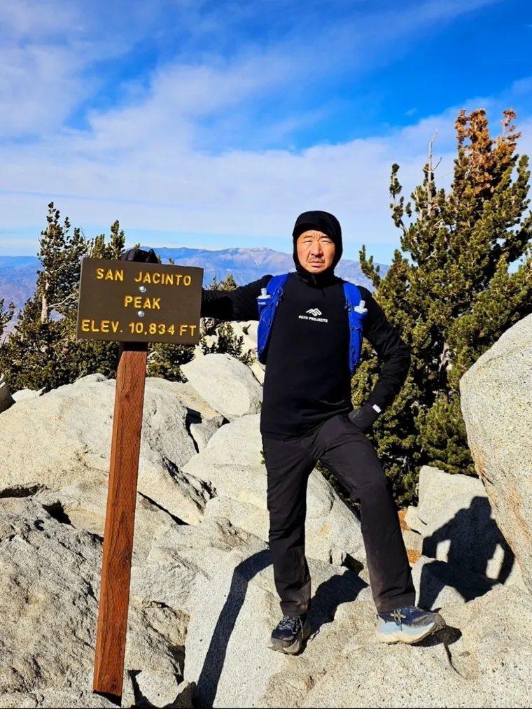
The summit sign is a brown wooden sign on a post with yellow letters reading SAN JACINTO PEAK, ELEV. 10,834 FT, set among the granite boulders on top. It's about chest height, so you can stand right beside it, like the hiker in the photo above.
Getting the summit photo
- Stand next to the post so your hand or shoulder is near the sign and both read clearly.
- Get your whole body in, head to boots. The boulders on top make a good step for the photographer.
- Face the sun if you can. The sign's letters catch the light and read sharper.
San Jacinto Peak questions
Do you need a permit to hike San Jacinto Peak?
Yes, a free day-use wilderness permit, from the Idyllwild headquarters or the Long Valley Ranger Station at the top of the tram. State Parks and the Forest Service honor each other's day-use permits.
What's the easiest way up San Jacinto Peak?
From the top of the Palm Springs Aerial Tramway: about 11.6 miles round trip via Round Valley, with about 2,400 feet of gain.
How tall is San Jacinto Peak?
10,834 feet per California State Parks, which is what the summit sign says. The Forest Service lists 10,804 feet.
What does the summit sign say?
SAN JACINTO PEAK, ELEV. 10,834 FT, on a brown wooden sign on a post.
Carry your San Jacinto Peak summit
Tram or the long way from Idyllwild, you earned the view from 10,834 feet. We cut the shot beside that wooden sign to your outline with the sign kept in, so it comes with you on every hike after.
One email when charms are ready to order. Unsubscribe anytime.
Launching soon · $29 with free US shipping · Made right, or made again
Proud of someone who just made the top? Use the photo they sent you and give them their summit to carry. How gifting works
Sources
- California State Parks, Mount San Jacinto State Park.
- California State Parks, Mount San Jacinto trails.
- USDA Forest Service, San Bernardino National Forest, San Jacinto Wilderness.
- California State Parks, Mount San Jacinto permits.
- Palm Springs Aerial Tramway, About the tramway.
- California State Parks, Civilian Conservation Corps at Mount San Jacinto.
Permit rules, tram hours and trail conditions change. Check State Parks and the tram before you go. Facts checked October 2026.