Peaks · New Hampshire
Mount Washington, the Northeast's highest peak
The top of the Northeast, famous for some of the wildest weather anywhere. Here's the climb, what's on top, and how to get the summit photo.
Mount Washington at a glance
- Summit elevation
- 6,288 feet1,2
- Standing
- The highest peak in the Northeast1,2
- Where
- Mount Washington State Park in New Hampshire's White Mountains, run by the NH Department of Natural and Cultural Resources. The trails around it are managed jointly by the White Mountain National Forest and NH State Parks.1,4
- Tuckerman Ravine Trail
- 3.9 miles to the summit from the Pinkham Notch Visitor Center on Route 16, passing the Hermit Lake Shelters at 2.3 miles4
- Other ways up
- The Mount Washington Auto Road and the Cog Railway also reach the top. Each sets its own schedule and rates.1
- Fees and parking
- No trail fee is listed for the Pinkham Notch trails. The lot can fill on busy days, so have a backup trail in mind.4
- Weather
- A 231 mph wind was recorded on the summit on April 12, 1934. The average temperature up top is 27.1 F with an average wind of 35 mph, and winds pass hurricane force on more than 100 days a year.2,3
- Summit services
- The summit building has a visitor center, cafeteria, restrooms and the Observatory's museum in season. It closed for the 2026 season on October 16, and off season the park is usually unstaffed.1
The summit sign
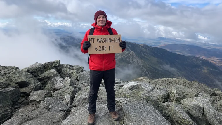
There's a summit sign on top, and the state park shows it on its own page, but the sources we read don't spell out its wording. Around it you'll find the summit building with its viewing deck, the Mount Washington Observatory, and the historic Tip Top House next door. Whatever sign ends up in your photo, your charm keeps it.
Getting the summit photo
- Stand right beside the summit sign so both you and the lettering fill the frame.
- Get your whole body in, head to boots, and brace for wind before you pose.
- Shoot when the clouds part. Views can stretch more than 100 miles on a clear day.
Mount Washington questions
How tall is Mount Washington?
6,288 feet. It's the highest peak in the Northeast.
What's the most popular trail up Mount Washington?
The Tuckerman Ravine Trail runs 3.9 miles to the summit from the Pinkham Notch Visitor Center, past the Hermit Lake Shelters at 2.3 miles. You can also reach the top by the Auto Road or the Cog Railway.
Is the weather on Mount Washington really that bad?
It can be. A 231 mph wind was recorded on the summit in 1934, the average temperature up top is 27.1 F, and winds pass hurricane force on more than 100 days a year. Check the Observatory's higher summits forecast before you go and bring wind and rain gear and warm layers.
Is there a summit sign on Mount Washington?
Yes, there's a summit sign on top. Whatever sign you stand beside, we keep it in your charm.
Carry your Mount Washington summit
You stood on the top of the Northeast, in some of the wildest weather on the map. We cut that photo to your outline with the summit sign kept in, so that hard-won day rides on your pack for every hike after.
One email when charms are ready to order. Unsubscribe anytime.
Launching soon · $29 with free US shipping · Made right, or made again
Proud of someone who just made the top? Use the photo they sent you and give them their summit to carry. How gifting works
Sources
- NH State Parks, Department of Natural and Cultural Resources, Mt. Washington State Park.
- Mount Washington Observatory, The World's Worst Weather.
- NH State Parks, Department of Natural and Cultural Resources, About its weather (PDF).
- Trail Finder, Upper Valley Trails Alliance, Mount Washington: Pinkham Notch Trailhead.
Summit weather turns fast and services are seasonal. Check the Mount Washington Observatory's higher summits forecast and Mount Washington State Park before you go. Facts checked October 2026.