Peaks · North Carolina
Mount Mitchell, the highest point east of the Mississippi
The top of the eastern United States, with an observation deck at the summit and Fraser fir forest all around. Here's the hike, the drive, and how to get the summit photo.
Mount Mitchell at a glance
- Summit elevation
- 6,684 feet1,2,5
- Standing
- The highest point east of the Mississippi River1,2
- Where
- Mount Mitchell State Park, North Carolina's first state park (1915), in Yancey County about 30 miles northeast of Asheville. Reached by a side trip from Blue Ridge Parkway milepost 355.1,2,5
- Mount Mitchell Trail
- From Black Mountain Campground, a Forest Service campground, up to the state park, about 5.6 to 5.7 miles one way depending on the source, with 3,630 feet of elevation change. Rated strenuous. The Forest Service lists it as temporarily closed, so check before you go.3,4
- Fees
- No fee for day use of the state park. Camping and some permits cost extra.1
- Road access
- The park is reachable only from the Asheville side of the Blue Ridge Parkway, and there are no gas stations between Asheville and the park. Winter Parkway closures can close the park for long stretches.1
- Weather
- The top is often several degrees colder than the town of Burnsville below.1
What's on top
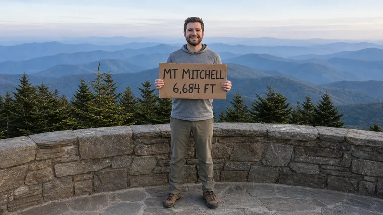
The summit has an observation deck with long views on a clear day. Right next to it is the stone grave of the scientist the mountain is named for, with an iron fence and a bronze plaque put up in 1926. The sources we read don't describe a summit sign, so the photo most people keep is on the deck with the Black Mountains behind them.
Getting the photo
- Stand at the deck rail with the ridgeline behind you, or bring your own sign with the name and height.
- Get your whole body in, head to boots.
- Go on a clear day. Clouds can hide the view, and it's colder up top than in town.
Mount Mitchell questions
How tall is Mount Mitchell?
6,684 feet. It's the highest point east of the Mississippi River.
Can you drive to the top of Mount Mitchell?
You can drive into Mount Mitchell State Park from Blue Ridge Parkway milepost 355, on the Asheville side only. Day use of the park is free.
Can you hike up Mount Mitchell?
Yes. The Mount Mitchell Trail climbs from the Forest Service's Black Mountain Campground, about 5.6 to 5.7 miles one way with 3,630 feet of elevation change. Check its status first, since the Forest Service has listed the site as temporarily closed.
Is there a summit sign on Mount Mitchell?
The summit has an observation deck and a historic grave and plaque, but the sources we read don't describe a summit sign. Any photo from the top works, and we keep whatever you're holding.
Carry the top of the East
You stood higher than anyone east of the Mississippi. We cut that photo to your outline, sign and all if you brought one, so you can carry it on every hike after.
One email when charms are ready to order. Unsubscribe anytime.
Launching soon · $29 with free US shipping · Made right, or made again
Proud of someone who just made the top? Use the photo they sent you and give them their summit to carry. How gifting works
Sources
- NC State Parks, Mount Mitchell State Park.
- National Park Service, Blue Ridge Parkway, Mount Mitchell.
- NC State Parks, Mount Mitchell State Park trails.
- USDA Forest Service, National Forests in North Carolina, Mount Mitchell Trail #190.
- NC Department of Natural and Cultural Resources, Mount Mitchell history, highway marker N-38.
Parkway closures and trail damage can change access. Check Mount Mitchell State Park and the Blue Ridge Parkway road status before you go. Facts checked October 2026.