Peaks · Maine
Katahdin, Maine's highest peak
Maine's tallest mountain and the northern end of the Appalachian Trail. Here's the climb to Baxter Peak, the trailhead pass you need, and how to get the summit photo.
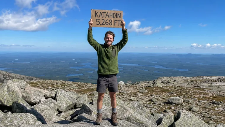
Mount Katahdin at a glance
- Summit elevation
- 5,268 feet at Baxter Peak, the figure Baxter State Park now uses on its signs and map. Older signs and a 1932 plaque near the summit say 5,267 feet, and survey sources differ by about a foot.2
- Standing
- Maine's tallest mountain and the northern end of the Appalachian Trail3
- Where
- Baxter State Park, Maine1,3
- Hunt Trail
- The Appalachian Trail route, 5.2 miles one way from Katahdin Stream Campground to the summit, with more than 4,000 feet of gain1,3
- Other routes to Baxter Peak
- Abol Trail 4.4 miles one way (including 1 mile on the Hunt Trail), Saddle Trail 2.2 miles and Cathedral Trail 1.7 miles1
- Trailhead pass
- You need a Katahdin Trailhead Pass, one per vehicle, to park at Katahdin trailheads from June through October unless you're camping in the park the night before. Passes open April 1, aren't needed in May, are limited to two per calendar month and aren't refundable. Be in line at Togue Pond Gate by 7 a.m. or you lose your spot.1
- Fees and rules
- Visitors who aren't Maine residents pay an entrance fee. No pets, firewood, drones or parties over 12.1
- Safety
- Plan on 8 to 12 hours round trip and at least 2 quarts of water each. Set a turnaround time, since many rescues happen on the way down. The Hunt Trail is above treeline for more than 2 miles below the summit with no shelter, and the Knife Edge is fully exposed in bad weather or high wind.1,3
The summit sign
Baxter Peak has a summit sign. The park planned to replace the old, weathered one in summer 2026 with a new sign showing 5,268 feet, and a 1932 metal plaque near the summit still reads 5,267. Whichever one is in your photo, your charm keeps it.
Getting the summit photo
- Stand beside the Baxter Peak sign so the lettering reads clearly behind or next to you.
- Get your whole body in, head to boots, with the open tableland around you.
- Take it quickly and keep your turnaround time. The descent is where many rescues happen.
Mount Katahdin questions
How tall is Katahdin?
Baxter State Park now lists Baxter Peak at 5,268 feet. Older signs and a 1932 plaque near the summit say 5,267, and survey sources differ by about a foot. Either way it's Maine's tallest mountain.
Do you need a reservation to hike Katahdin?
From June through October you need a Katahdin Trailhead Pass for your vehicle to park at a Katahdin trailhead, unless you're camping in the park the night before. Passes open April 1 and aren't needed in May.
Which trail should I take up Katahdin?
The Hunt Trail is the Appalachian Trail route, 5.2 miles one way from Katahdin Stream Campground with more than 4,000 feet of gain. The Abol Trail is 4.4 miles one way. Plan on 8 to 12 hours round trip on any route.
Is there a summit sign on Katahdin?
Yes. Baxter Peak has a summit sign, and the park planned a new one for summer 2026. Whatever sign is in your photo, we keep it in your charm.
Carry your Mount Katahdin summit
Maybe the last step of the whole Appalachian Trail, maybe one long, hard day from the trailhead. Either way you stood on the top of Maine. We cut that photo to your outline with the Baxter Peak sign kept in, so you can carry the day on every hike after.
One email when charms are ready to order. Unsubscribe anytime.
Launching soon · $29 with free US shipping · Made right, or made again
Proud of someone who just made the top? Use the photo they sent you and give them their summit to carry. How gifting works
Sources
- Baxter State Park, General information.
- Baxter State Park, What's new this year.
- Appalachian Trail Conservancy, Hiker's guide to Katahdin.
Trail work in 2026 includes a Hunt Trail bridge replacement near Katahdin Stream Falls with a temporary bypass. Check with Baxter State Park before you go. Facts checked October 2026.