Peaks · Colorado
Mount Elbert, Colorado's highest peak
The top of Colorado and the second highest peak in the lower 48. Here's the climb, what's on top, and how to get the summit photo.
Mount Elbert at a glance
- Summit elevation
- 14,433 feet (4,399 meters), the Forest Service figure. Newer survey data puts it a few feet higher, and many hikers' signs say 14,440.1,3
- Standing
- Colorado's highest peak and the second highest peak in the lower 48 states1
- Where
- San Isabel National Forest, Leadville Ranger District, near Leadville1,2
- North Mount Elbert Trail
- Trail #1484, about 4.3 miles to the summit with about 4,400 feet of gain, from the trailhead off Halfmoon Road near Elbert Creek Campground1
- South Mount Elbert Trail
- Trail #1481, about 5.8 miles one way with about 4,800 feet of gain1
- Permits
- None needed for individual hikers. Commercial and organized groups need a permit from the Leadville Ranger District.1
- Weather
- Afternoon thunderstorms are frequent and build fast. The Forest Service advises getting below timberline at the first sign of one.1
The summit sign
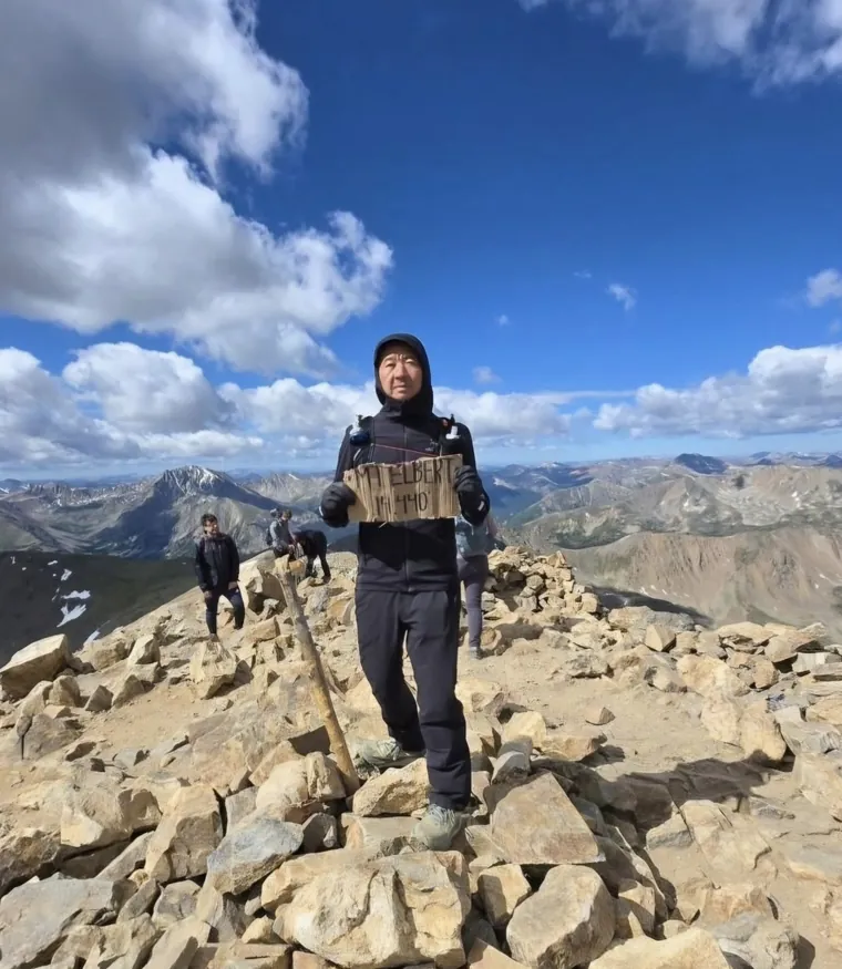
The summit is a broad, rocky top. Many hikers carry up their own sign, often hand-lettered cardboard like the MT ELBERT 14,440 sign in our photo, to hold up for the photo. Make yours big and dark so it reads, and your charm keeps it right in your hands.
Getting the summit photo
- Bring your own sign and write the name and height large, in thick dark marker.
- Hold it at chest height, in front of you, so it doesn't cover your face.
- Get your whole body in, head to boots, and take it early before the afternoon storms build.
Mount Elbert questions
How tall is Mount Elbert?
The Forest Service lists 14,433 feet (4,399 meters). Newer survey data puts it a few feet higher, and many hikers write 14,440 on their summit signs. Either way it's Colorado's highest peak and the second highest in the lower 48.
Do you need a permit to hike Mount Elbert?
Not as an individual hiker. Commercial and organized groups need a permit from the Leadville Ranger District.
Which trail should I take up Mount Elbert?
The North Mount Elbert Trail is the shorter of the two Forest Service routes, about 4.3 miles to the summit with about 4,400 feet of gain. The South Mount Elbert Trail is about 5.8 miles one way with about 4,800 feet of gain.
Is there a summit sign on Mount Elbert?
Many hikers bring their own, often hand-lettered cardboard. Whatever sign you hold up, we keep it in your charm.
Carry your Mount Elbert summit
All those training miles, for the top of Colorado. We cut your summit photo to your outline with your sign kept in, so you carry the highest point in the state on every hike after... proof you stood there.
One email when charms are ready to order. Unsubscribe anytime.
Launching soon · $29 with free US shipping · Made right, or made again
Proud of someone who just made the top? Use the photo they sent you and give them their summit to carry. How gifting works
Sources
- USDA Forest Service, Pike & San Isabel National Forests, Mount Elbert Fourteener.
- Colorado Trail Explorer, State of Colorado, North Mt. Elbert.
- NOAA National Geodetic Survey, preliminary 2024 summit heights for Colorado peaks.
Trail and weather conditions change. Check with the Leadville Ranger District before you go. Facts checked October 2026.